Build it and they will Come
〰️
Build it and they will Come 〰️
Lobo Canyon Trails
Lobo Canyon Trail work Every Thursday night Starting March 20, 2025 thru October 23, 2025: from 4:30 PM to 6:30 PM
We will not work on Thursday July 3, 2025
email president@cibolatrails.org for location or directions
CTA will provide the work tools, we have a few hard hats and gloves for some, but we recommend if you have your own hard hat and Gloves you bring those please. You must wear closed toe shoes (no Sandals), a long sleeve shirt, long pants and no shorts. We are volunteer partners of the Mt Taylor Ranger District and we must follow all safety procedures while out on the trail.
The Lobo Canyon Trails Project is a multi-phase initiative aimed at expanding non-motorized recreational access in the Mount Taylor Ranger District of the Cibola National Forest & National Grasslands, located 5-11 miles northeast of Grants, New Mexico. The project will establish a stacked loop trail system that spans over 23 miles and connects key access points, including the Continental Divide Trailhead and Coal Mine Campground.
Key Features - Location and Terrain; Elevation: 7,000' - 8,000'; Vegetation: Juniper, piñon, and ponderosa pine forests with pockets of oak and other brush.
Terrain: Moderately steep with some gentler areas. High concentrations of rock formations (including sandstone bedrock) characterize the landscape.
Trail Segments:
The trails will be divided into Priority 1, 2, and 3 segments, with priority based on user input, accessibility, and environmental conditions.
Priority 1:
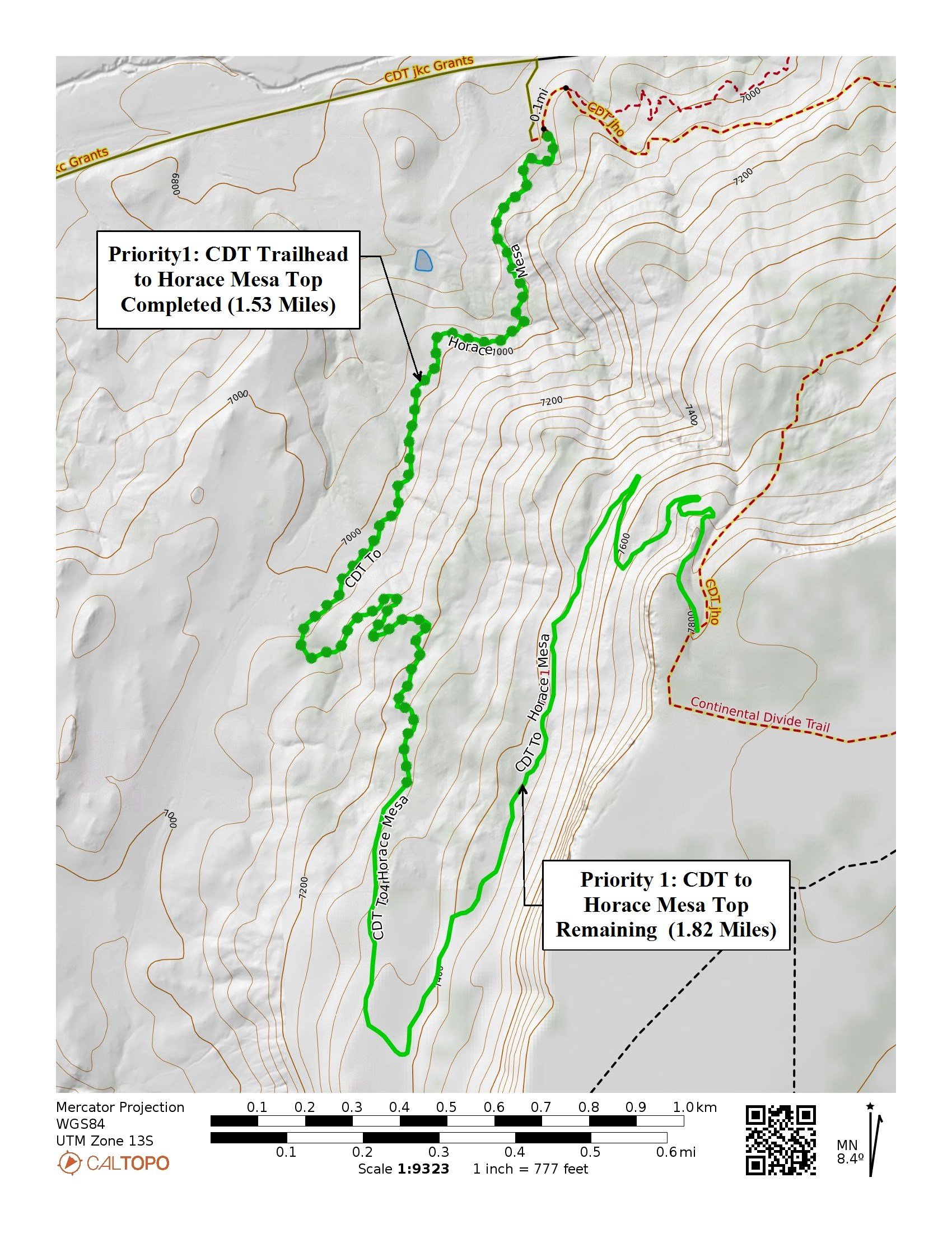
Includes the small loop near Coal Mine Campground (completed in fall 2022) and a segment accessed from the Continental Divide Trail (CDT), which climbs the mesa southwest of the current CDT alignment. The goal here is to provide a loop for CDT users to avoid out-and-back travel on the same route.
Priority 2:
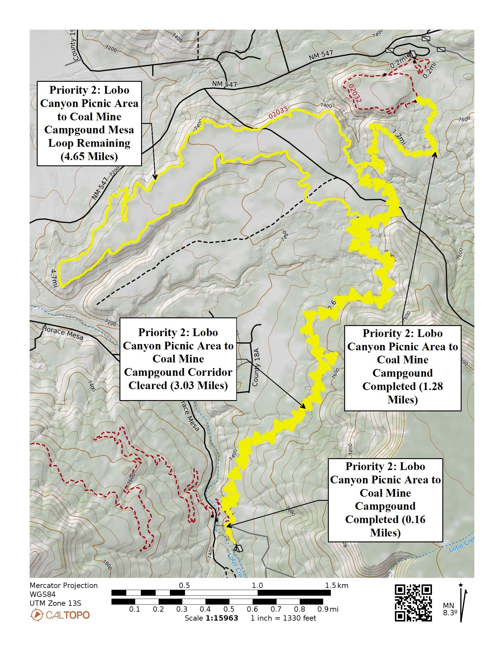
A segment between Coal Mine Campground and the Lobo Canyon Picnic Area, including an additional loop for a more enjoyable trail experience.
Priority 3:
The longest and most technical section between the Lobo Canyon Picnic Area and the CDT trailhead. This section will be constructed last to allow the application of lessons learned from the Priority 1 and 2 sections.
Project Goals: To create a 23-mile non-motorized trail system that is accessible year-round for residents, tourists, and visitors.
To enhance outdoor recreation opportunities in the region, serving as a boost to the local economy by attracting outdoor enthusiasts and supporting local businesses.
To provide a variety of trail experiences, from moderate loops to more technical sections, catering to a range of skill levels and encouraging responsible use of the trails year-round.
Benefits to the Community: The trail system will greatly increase access to outdoor recreation opportunities for Cibola County residents, offering a much-needed expansion of non-motorized trails in the area.The project aligns with broader goals to promote economic growth by attracting tourism and supporting local businesses, ultimately helping to grow the outdoor recreation sector in the region.This project represents a significant development in outdoor recreation infrastructure, aimed at fostering sustainable tourism, recreational use, and economic vitality for the local community.
What’s NEXT: The Cibola Trail Alliance (CTA) has played a key role in all aspects of construction for the Lobo Canyon Trail System to date and will continue to support the project throughout its full implementation. Upon completion, CTA will be well-positioned to serve as the long-term caretaker of this trail system, as well as other trails in the region. While trail construction can be a demanding process, trail maintenance, although also challenging, typically involves tasks such as small re-routes and routine upkeep, which align well with CTA’s capabilities.
Volunteers will be recruited through a variety of methods, including advertising trail workdays, hosting group recreation events, and engaging in regional outdoor activities. CTA will continue its training efforts, which have been in place for several years, by organizing trail-building and maintenance workshops in collaboration with the US Forest Service (USFS) and organizations such as the Continental Divide Trail Coalition. Chainsaw work, which involves removing trees from the trail and identifying and addressing hazard trees, is a critical part of maintenance in the area. Specialized chainsaw training and certifications will continue to be provided by the USFS to ensure volunteers are properly equipped.
Funding for regular maintenance tasks will primarily come from fundraising efforts and the City of Grants Lodger Tax grant application. For larger maintenance projects requiring additional funding, CTA will pursue grants from sources such as Trails Plus
The Goals of Cibola Trail Alliance committee include that for the LCT system:
Creation of a multistakeholder partnership for sustainable development of Lobo Canyon Region which focuses on conservation
Coordination of public outreach and involvement including community events, public meetings and forums, GIS mapping events, etc.,
Assistance with development of a public mapping process and on the ground information gathering and GIS information integration
Development of a Lobo Canyon Trails System with trail connections and linkages to surrounding communities to provide access to area asset
Identification, inventory, and prioritization of sensitive areas and potential restoration projects, such as closing or rehabilitating unneeded routes, throughout the project area
The Objectives of the CTA include:
Establish multiuse trail system for equestrian, mountain biking and hiking trails throughout the Mt. Taylor area that reduces resource impacts from user created trails. This system would eventually provide a variety of trailheads and associated facilities such as stackedloop trails and experiences for beginner, intermediate, and advanced mountain bike riders
Create new gateway trails that provide close to home recreation opportunities for the public in the Mt. Taylor Area
Create and sustain strong and diverse partnerships that support increased recreational visitation, recreational tourism, economic development, and trail stewardship
Enhance forest and watershed health by adhering to best management practices for forest road management (road closures and decommissioning) and new trail development. Old logging road corridors may be utilized by users if converted to sustainable singletrack routes
Design trails to protect heritage resources through routing and/or interpretive opportunities, as heritage resources (mining and historic railroad logging) are abundant and important on Mt Taylor. Trails . A properly functioning system will reduce current impacts to historic resources. Establishing the proposed trail system will direct current users away from impacted areas and reduce resource damage. In time, heritage personnel may identify backcountry interpretive opportunities as trail use patterns develop
Address visitor risk and safety by appropriate trail location and design, minimizing road crossings, addressing potential user conflicts by separating noncompatible users, and locating and developing trailheads with user safety in mind
Respect private property rights. Trails will not be designed to terminate at a private property boundary and trails crossing private property will require legal access
Consider and analyze trail routes identified in alternative development as additional corridors. Requiring field analysis (with data supplied for location) will include routes from Grants Ridge, Horace mesa, and on to the greater Mt. Taylor area
Include outreach to local governments for stronger relationships. The partnership will build new bridges through programs such as the National Indian Youth Leadership Program and develop communication strategies through tribal members who are interested in trail related activities such as tribal member health and wellness, forest stewardship, running, bicycling, or gathering forest products
Connect the proposed Lobo Canyon Trails Project to the existing Continental Divide trail and Coal Mine campground in efforts to maintain and improve the area which can prove to be beneficial to the community
The Lobo Canyon Trail Project has received support from several local entities, including the City of Grants, Cibola County and the Grants Main Street Project.
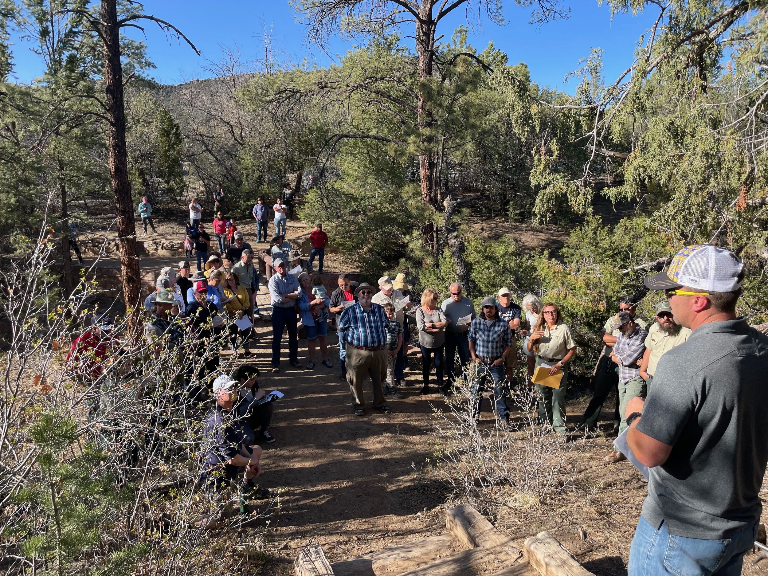
Friday May 13, 2022 Trail Building Commencement
Community support for Lobo Canyon Trails
Groundbreaking Times
Cibola Trail Alliance Staff and Board. Left Dhanielle, Donna, Chad and Adam. Not pictured are Isaac, Patricia (Pat) and Michael
Out on Newly Constructed Trail
Diner is served. What a great group of folks out in support of the new project.


